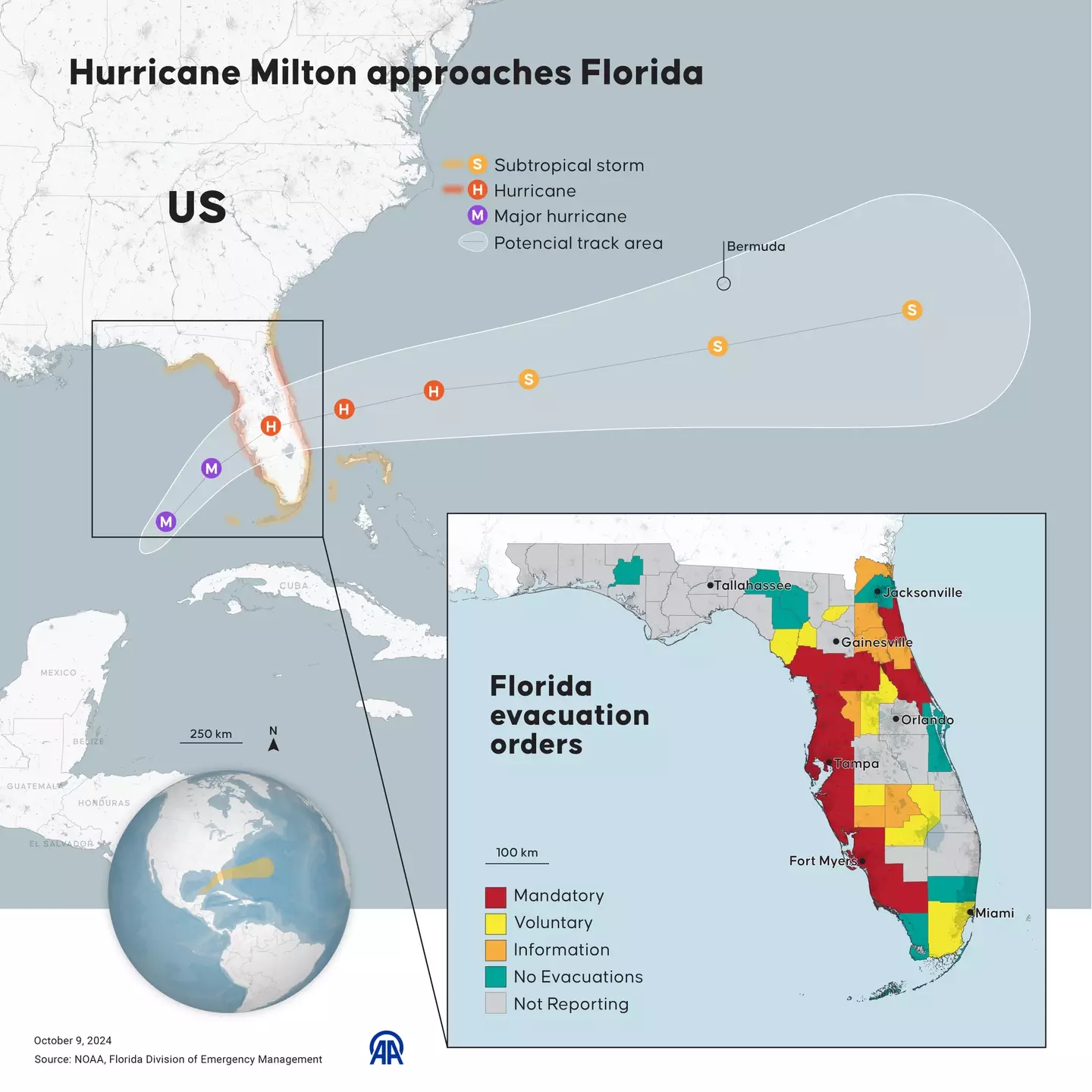
Hurricane Milton is set to devastate the United States, with the monstrous Category 5 storm set to bring surging walls of water across large swathes of the Florida coastline, as well as Georgia and South Carolina.
And with millions of residents across the state urged to leave their homes or risk losing their lives, simulations of just how shocking the flood water will be have been published across weather and news networks in the USA.
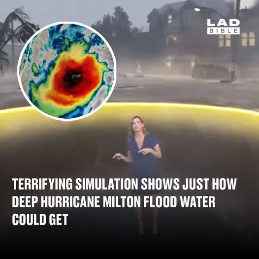
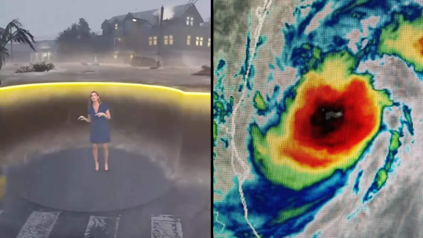
The Weather Channel is among these, publishing a clip with presenter Stephanie Abrams using FloodFX simulation technology to show exactly why you should be listening to the official advice and not staying put.
Florida is set to be hit hard (Yasin Demirci/Anadolu via Getty Images)
It is after some residents have insisted they will stay in their homes despite being ordered to evacuate. Officials have warned that those staying behind will face incredibly low odds of surviving.
The Tampa Bay area, home to more than 3.3 million people, faces the possibility of widespread destruction after avoiding direct hits from major hurricanes for more than a century.
The US National Hurricane Centre predicted Milton would likely weaken but remain a major hurricane when it makes landfall late on Wednesday (9 October).
Milton was centred early on Wednesday about 360 miles south-west of Tampa with maximum sustained winds of 160mph, the National Hurricane Centre reported.
Tampa Mayor Jane Castor said that up to 15 feet of storm surge water forecast for her city would be deep enough to swallow an entire house, meaning you’re not safe even if you think you can outlast it on the first floor or attic levels.
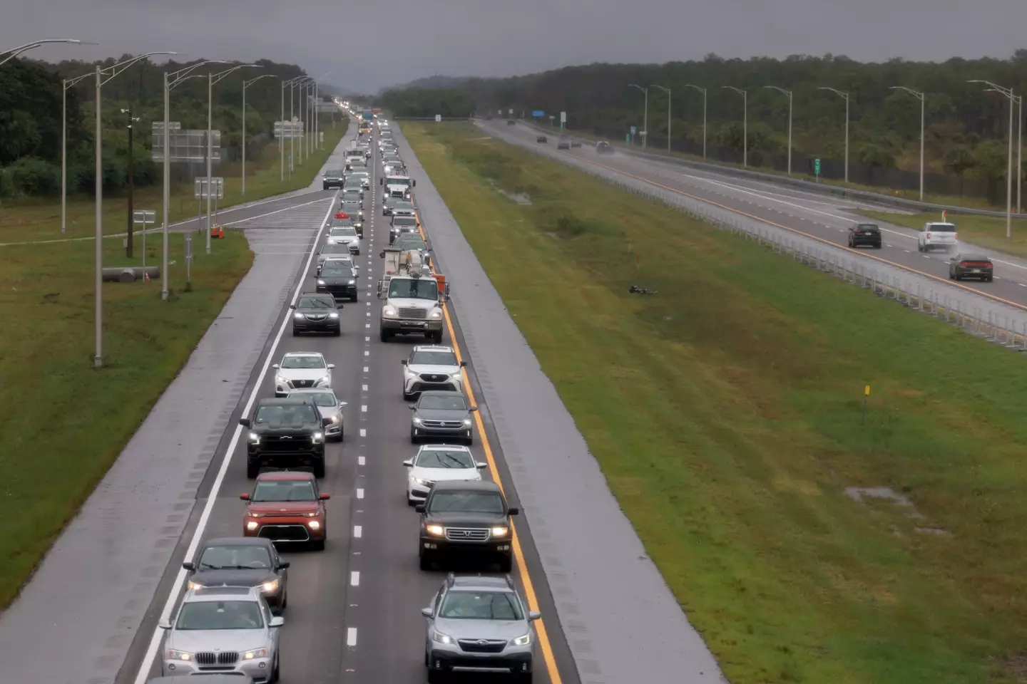
Floridians leaving the state ahead of the arrival of Hurricane Milton (Joe Raedle/Getty Images)
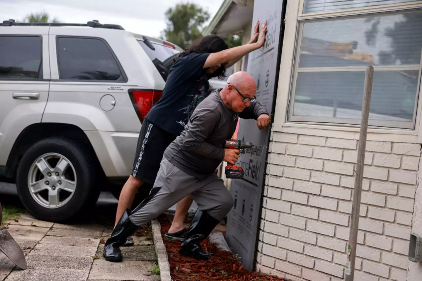
Residents are doing their best to secure their homes ahead of the hurricane’s arrival (Joe Raedle/Getty Images)
Setting up in The Weather Channel studio, Abrams is surrounded by flooding simulation graphics to showcase just why people should be evacuating and not staying put if flooding is expected in their path.
Showing what the flooding looks like at three, six and nine feet tall, it’s a harrowing look at why millions have been ordered to leave their homes.
“Let’s focus in on the Tampa Bay area where we could see a record setting surge over nine feet,” Abrams tells The Weather Channel viewers.
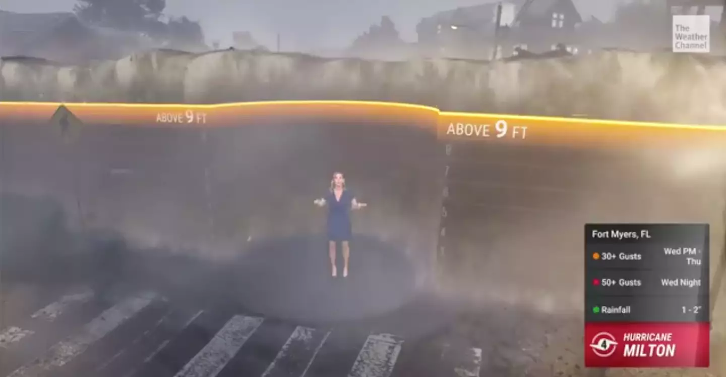
This is what nine feet of floodwater looks like (Weather Channel)
“We can use this simulation to show you what it will look like in Tampa. At three feet above dry ground, water is already life threatening. It is too late to evacuate. Water this high can knock you off your feet, make cars float and make driving impossible.
“The first floor of homes and businesses are flooded. Unfortunately the water is expected to rise even higher to six feet, above the height of most people. Vehicles get carried away, structures start to fail, just look at this.
“Anything could be in this water – sharp glass, debris, chemicals. Some areas could then see surge values at 10 to 15 feet.”
Abrams continues: “This takes us up to nine feet and look what it does. At this level, the first floor of structures are completely flooded and there are few places where it is safe when water rises this high.
“We want everyone to know their evacuation zone, listen to local officials, and evacuate when ordered to do so.
“This is not just a calm water, you’ll going to have waves and even white caps on the water inland.”
Featured Image Credit: The Weather Channel / NOAA / NESDIS Center for Satellite Applications and Research